


![[Gift for Order over £1300] Bluetooth Speaker with Phone Stand - Shipped from July](http://uk.jackery.com/cdn/shop/files/Portable_Bluetooth_Speaker_with_Phone_Stand_2.png?v=1781595581&width=170)


Ben Nevis, the highest peak in the United Kingdom, stands at 1,345 metres above sea level and is a must-see destination for hikers. The time required to climb Ben Nevis varies based on the route, physical ability, and weather conditions, with most ascents lasting 7-8 hours. Beginners often follow the Mountain Track, while expert hikers may use the difficult Carn Mor Dearg Arête. Preparation, fitness, and the right equipment are critical for success.
From unpredictable weather to spectacular summit vistas, this guide has everything you need to know before climbing Scotland's most significant peak and embarking on an incredible outdoor experience.
|
Key Takeaways: |
|
How Long Does It Take to Hike Ben Nevis?
Climbing Ben Nevis takes around 3½ - 4½ hours via the Mountain Track in July, depending on fitness level and break duration. The descent from the mountain to your starting position takes around 2½ - 3½ hours.
If you or one of your party members is slower than average, it might take much longer.
In winter, particularly when there is snow on the ground, ascending to the top of Ben Nevis via the Mountain Track may take up to 8 hours (or more), with a descending time of around half that, so plan accordingly.
|
Facts About The Hikes |
|
|
Starting Point |
Ben Nevis Visitor Centre, Glen Nevis, Fort William, Scotland PH33 6PF. |
|
Distance |
16 km Elevation gain: 1,448 metres |
|
Elapsed Time |
8 hours 9 minutes |
|
Moving Time |
5 hours 54 minutes |
|
Difficulty |
Strenuous |
Can Beginners Climb Ben Nevis?
Beginners may climb Ben Nevis via the Mountain Track. You should be reasonably fit and capable of carrying a rucksack weighing 3-4 lbs.
It is critical to try the summit on a day when favourable weather is expected. Regardless of the weather prediction, plan on chilly, windy, and rainy days.
Naismith's Rule
The most frequent method for predicting your time is to utilise Naismith's Rule, a formula developed by William W. Naismith, a Scottish climber, in 1892 to determine the time required to climb mountains. There have been some changes and adjustments made over the years, but the rule of thumb has survived the test of time rather well.
He estimated that it would take one hour for every three miles, plus one hour for every 2,000 feet of elevation. In metric terms, it equates to one hour for every five kilometres and one hour for every 600 metres of elevation.
Naismith's may be further divided into periods for speed and distance
|
Naismith's Rule Timing Chart |
||||
|
Distance Travelled |
Speed in Kilometres per Hour |
|||
|
5 kph |
4 kph |
3 kph |
2 kph |
|
|
1000 Metres |
12 min |
15 min |
20 min |
30 min |
|
900 Metres |
11 min |
13½ min |
18 min |
27 min |
|
800 Metres |
9½ min |
12 min |
16 min |
24 min |
|
700 Metres |
8½ min |
10½ min |
14 min |
21 min |
|
600 Metres |
7 min |
9 min |
12 min |
18 min |
|
500 Metres |
6 min |
7½ min |
10 min |
15 min |
|
250 Metres |
3 min |
4 min |
5 min |
7½ min |
|
100 Metres |
1 min |
1½ min |
2 min |
3 min |
Also, time should be given for each metre of climb.
|
Naismith's Rule - Ascent |
|
|
Metres Climbed |
Time to Be Added |
|
10m |
+1 min |
|
20m |
+2 min |
|
50m |
+5 min |
|
100m |
+10 min |
|
250m |
+25 min |
|
500m |
+50 min |
|
600m |
+60 min |
|
700m |
+70 min |
|
800m |
+80 min |
|
900m |
+90 min |
|
1000m |
+100 min |
|
1100m |
+110 min |
|
1200m |
+120 min |
|
1300m |
+130 min |
|
1350m of ascent |
+135 min |
(Data Source: Ben Nevis)
During acceptable summer weather, we may use Naismith's to compute the time to be added to the uphill half of the rule: 135 minutes. The distance to the top of Ben Nevis is around 8,500 m, so assuming you can maintain a speed of 5 kph for the length of the trip and do not take any pauses, the distance travelled portion of the rule yields 102 minutes.
Add them all together to obtain a total of 237 minutes (3 hours 57 minutes). Obviously, it is different for everyone, and some individuals can climb Ben Nevis more quickly than others. In general, the more fit you are, the quicker you will reach the top. But it isn't a race (unless it is), so take the time to glance about throughout your walk to take in some of the unique and spectacular surroundings. If you don't, all you'll remember about climbing Ben Nevis is the gravel road and nothing more.

Ben Nevis – Common Questions Answered
The following are some questions that people ask most about hiking Ben Nevis:
How High Is Ben Nevis?
Ben Nevis is, by far, Scotland's tallest peak. The trig point is 1,345m high, 36m higher than the Cairngorms National Park's second-highest peak, Braeriach.
The Ben is also substantially higher than any of the surrounding peaks. Hence, the views from the summit are expansive in every direction, looking down on the surrounding Mamores, across to Glen Coe, north as far as Fisherfield Forest, and west to the Scottish Islands.
The disadvantage of such height, however, is that any ascending method is lengthy and arduous. The majority of the designated pathways and trails begin around sea level, so you'll feel every single one of those 1,345m (both up and down the mountain) in your legs by the end of the day.
Where Is Ben Nevis Located?
Ben Nevis stands above the village of Fort William in the western Highlands, only a few miles from the northern point of Loch Linnhe. It's around 110 miles and three hours from Glasgow by automobile, with the majority of the route on the A82, which runs along Loch Lomond and through Glen Coe before arriving at Fort William.
The peak may also be accessed quite easily from Inverness in the north, via the A82, which runs beside Loch Ness before passing over Spean Bridge to Fort William. Scotrail runs services from Fort William train station to Glasgow City Centre, and there is also a frequent bus service to the Ben Nevis region.
How Long Does It Take To Climb Ben Nevis?
That is determined by the route you choose and your level of fitness. The Mountain Track is the busiest route on Ben Nevis, taking an average of seven to eight hours to complete; however, Three Peaks Challenge hikers sometimes aim for five hours or fewer.
Longer and more demanding routes, such as the CMD Arête and Ledge Route, require more time and effort to complete.
What's The Weather Like?
Unpredictable! Ben Nevis develops its own weather systems, and the average yearly temperature at the top is barely below freezing. It is not unusual for the sun to shine in Fort William below as snow falls on the mountain's peak.
Even in the summer, you must be prepared for high winds, rain, low clouds, cold temperatures, and snow. If you're fortunate, you may even see some sunlight. The Mountain Weather Information Service is updated twice daily, and the Met Office's mountain prediction gives an hourly snapshot of the conditions you could encounter on the mountain.
Will I Get a Phone Signal?
Phone coverage may be intermittent and does not cover the entire mountain. If you use a GPS app that needs a signal, you cannot rely on it for navigation. Ensure you download any digital maps before your walk and always carry a paper map and compass.
What Is The Route Like?
The climb is quite steep and demanding, with rough terrain that becomes snowy as you ascend; particularly, the highest stretch is exceedingly rocky and rugged.
The beginning of the Mountain Track is delightful - a good start! The ground is pleasant to stroll on, and the grade is gentle. Following the Youth Hostel trail, the ground under your feet becomes a bit more challenging, and the steady slope is accompanied by stairs and small rocky areas that require significant focus.

What Is The Best Time Of Year To Climb Ben Nevis?
Ben Nevis can be climbed all year round; however, the experience varies according to the season. Summer ascents are often done between May and October, whereas winter ascents are done between November and April. It is usually best to plan your trek between June and September since harsh weather is less likely to occur.
Are There Restrooms On Ben Nevis?
Definitely not! The closest toilets are located at the Glen Nevis Visitor Centre, so use them before heading out and don't leave anything behind if you are caught short.
Can I Take My Dog?
You can, although ideally on a leash and always under constant supervision. Don't allow your dog to block other walkers, and keep in mind that sheep may graze up to 700m away.
The terrain consists of artificial stone walkways, scree, and bare rock, which may be hard on a dog's pads. So try them on comparable routes first.
How Should I Call Mountain Rescue In An Emergency?
First, are you sure you need to be rescued? Tiredness or running out of Skittles are insufficient grounds to activate a busy team of exhausted volunteers.
If there is a true emergency and you fear that you or one of your party is in danger, ring 999 or 112 and request police or Mountain Rescue. Before contacting us, please ensure you have your location and any relevant emergency information readily available.
Climbing Times Up Ben Nevis
Your fitness level is another crucial factor to consider while planning your walk to Ben Nevis. Remember that, although the track is well-marked, the height climb and hardness of the rocks in certain parts may be challenging. It's a rough walk, to be sure! Before you contemplate trekking Ben Nevis, do an honest evaluation of your fitness level.
If you're accustomed to hiking and in good physical condition, 9 to 10 hours on the path should be sufficient time to summit and descend.
If you're a part-time hiker who only goes out once or twice a month, consider spending some additional time getting to the peak. For people who are sedentary and do not walk often, allow at least 12 hours to climb and descend Ben Nevis.

In each scenario, bring enough water and food to keep you fuelled until you reach the summit safely. Generally, most walkers (weather permitting) may be divided into the following categories:
Fell Runners: 2-4 Hours
Fell runners go up and down the mountain at a speed that most of us cannot comprehend! They're probably not stopping to view the scenery since they're in a hurry.
Fit Walkers And Athletes: 4-5 Hours
Walking veterans or athletes in good enough shape to push up the mountain without much respite. Keeping a steady pace throughout, hikers who complete Ben in this time frame may be participating in the Three Peaks Challenge.
Experienced Walkers: 5-6 Hours
Not a stranger to walking, but not as experienced when it comes to conquering higher peaks. A few stops will likely be required to take in the scenery.
Novice Walkers: 6+ Hours
Hikers trying Ben Nevis who may not go on long treks very frequently. By no means an athlete, but sufficiently fit enough to climb the mountain at their own leisure, with plenty of time to rest along the route.
Which Ben Nevis Route Should I Take?
If you are not a seasoned hillwalker, the 'Mountain Path' or 'Pony Track' are for you. Do not tackle the much more challenging CMD Arête unless you have prior expertise with ridge trekking.
The Mountain Track is also known as 'the Ben Nevis tourist path', which makes it seem simple, although it is not.
While there is a steep trail most of the way, there are several terrifying drops at the summit, including the vertiginous Gardyloo Gully, shortly before the road ends. In severe weather, there are many huge summit cairns to follow. Please refrain from making cairns atop Ben Nevis, as you could inadvertently guide someone the wrong way in the fog.
Route Map

Is The Mountain Track Route Dangerous?
The most significant hazard on Ben Nevis is poor visibility. Because Ben Nevis is often cloaked in clouds, you'll need to exercise caution and make an informed choice about whether to do the walk. When you reach the top plateau, keep an eye out for gullies, which are famously undetectable in bad weather or when there is still snow on the summit, which may occur at any time of year. There have been deadly occurrences in which individuals stepped into a gully and fell down the mountainside.
The trail up Ben Nevis is well-defined and straightforward to navigate. The majority of it is paved with stone stairs. This may be incredibly exhausting, so you and your children will need to be physically healthy. Climbing Ben Nevis is the most challenging of the three National Peaks, the others being Snowdon in Wales and Scafell Pike in England, due to its significant height increase. You will gain around 1,350 metres over an 8-kilometre journey. It's a full-day trek that requires proper planning and hiking gear.
Main Routes To The Summit
There are two major walking routes up Ben Nevis.
Most walkers utilise the Mountain Track (also known as the Tourist Track or the Pony Track), although the Carn Mor Dearg Arête path provides a more difficult ascent for experienced hikers.
The Mountain Track
Best route for beginners. The most straightforward path up the mountain, the trail starts at the Ben Nevis Visitor Centre car park in Achintee on the east side of Glen Nevis, about 2 km from Fort William's town centre and 20 meters above sea level. The trail begins with a challenging climb to the halfway point, known as Lochan Meall an t-Suidhe, followed by winding, zig-zagging trails to the summit.
A cairn marks the top, and on a clear day, the spectacular 360° panoramic views may extend as far as Northern Ireland. From the summit, try to spot additional peaks, such as the Torridon Hills, Ben Lomond, and Morven in Caithness.
The Old Observatory, which opened in 1883, is one of the summit's distinguishing features. It generated hourly meteorological data for over 20 years, capturing some of the UK's most crucial mountain weather data to date. It closed in 1904 and is currently in ruins, yet it may still be utilised as a refuge in an emergency.
Carn Mor Dearg Arête
Best route for experienced hillwalkers.
Carn Mor Dearg Arête is the mountain's alternative hiking path, a challenging ridge climb that should only be undertaken by experienced scramblers and physically fit hillwalkers. Although difficult, the path offers trekkers the best views of the mountain's North face.
The route begins at the North Face car park in Torlundy and winds its way through two Munros: Carn Mor Dearg and Ben Nevis. It may also be accessed by following the Mountain Track to the 'halfway lochan' and taking the left branch, while the right fork continues along the Mountain Track. You'll pass the CIC Hut, a private mountaineering shelter.
This stunning path, which is longer and more challenging than the Mountain Track, may take 10-11 hours to complete and includes scrambles over rocks. It demands a strong sense of heights and cautious navigation through the more difficult, exposed areas.
Ben Nevis Tips and Facts
Before you climb Ben Nevis, it's essential to learn some valuable information and suggestions that will make your walk safer and more enjoyable. These tips will help you prepare for your trip and make the most of it by providing information about the mountain's specific conditions and safety guidelines.

Tip 1: Bring walking poles
Regardless of the route you choose, the descent will be lengthy and steep, placing a strain on your knees. Walking poles may relieve the tension.
Tip 2: Don't drink from streams
You may, of course, but it has not been safety tested, and on a busy day, there may be more than 1,000 people on the mountain. And there are no toilets!
Tip 3: Purchase midge spray
Midges are a prevalent pest in the Highlands throughout the summer months. Glen Nevis, in particular, is crawling with the little beasties when the weather permits.
Tip 4: Wear sunblock
On the admittedly occasional days of bright sunlight on Ben Nevis, especially if there is snow on the ground, it is all too easy to become sunburnt.
Tip 5: Make a weekend of it
If you decide to remain in the region for a few days (which you should), the Ring of Steall, a chain of four Munros that spans Glen Nevis to the south, makes for an excellent extra day of trekking. If you want an easier day, follow the short rocky road from Glen Nevis' head to An Steall waterfall. The view is terrific.
Facts And Stats
The average yearly temperature at the top of Ben Nevis is -1°C.
In an average year, the peak is pummelled by 261 gales and blanketed in overcast nine out of ten days.
The peak of Ben Nevis gets more than double the yearly rainfall of adjacent Fort William.
Approximately 75% of all Ben Nevis ascents take place along the Mountain Track (also known as the Pony Track or Tourist Track).
What Do I Need To Bring to Hike Ben Nevis?
The packing list shown below is for summer hiking on Ben Nevis. During the winter, you will need much more warm clothing. Because you will be going uphill, avoid wearing too much when you start. You'll quickly begin to feel heated. Although the mountain is not very high, plan to bring an additional two layers of clothes for the peak.

What To Wear:
Hiking Trousers
Sweat-wicking tee or long-sleeved shirt
Trekking boots: When trekking in Scotland, I use Salomon Trail Running Shoes. They are Lightweight, waterproof, and have an excellent grip, yet they take up much less space in my bag than traditional hiking boots.
What to Pack:
Daypack
Thin down jacket or fleece
Included items: Gore-Tex jacket, gloves, and hat
Waterproof trousers
Sunglasses
Sunscreen
Water bottle: a minimum of 2 L
Bring more than you typically eat for lunch
Snacks include chocolate, almonds, etc.
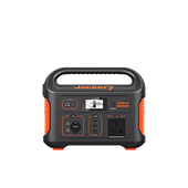
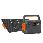
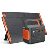
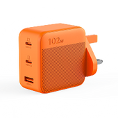
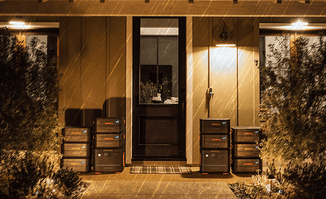
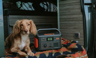
Jackery Explorer 300 Plus or 100 Plus portable power station
The most essential thing to remember about your gear is to avoid wearing cotton whenever feasible. Cotton absorbs moisture, leaving you feeling damp and chilly at best, hypothermic at worst. Whether you're trekking in the summer or winter, use wool or polyester gear. These textiles are excellent at wicking away sweat, keeping you comfortable and dry during your walk.
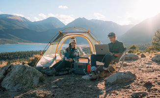
Jackery Portable Power Stations for Hiking
Taking a Jackery Portable Power Station on a hike to Ben Nevis is a crucial consideration for safety, communication, and comfort on the mountain. At the same time, a small power bank might suffice for a short day hike. Still, a portable power station offers a level of reliability and power that is crucial for a mountain with a reputation for unpredictable and harsh weather.
Ben Nevis is the UK's highest peak, and its weather is notoriously unpredictable. The summit can be 10°C colder than the base, and sudden changes to wind, rain, and fog are common. In these conditions, a charged phone and other electronic devices can be a lifeline.
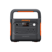
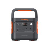
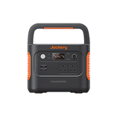
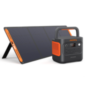
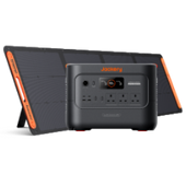
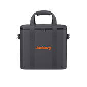
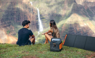
Jackery Explorer 300 Plus
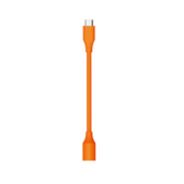
Taking a Jackery Explorer 300 Plus on a hike up Ben Nevis is a smart move that prioritises safety and convenience without adding excessive weight to your pack. While a larger power station might be overkill, the 300 Plus is specifically designed for this type of activity.

Lightweight Design: At just over 8.27 Ibs, the Explorer 300 Plus is an ultra-portable power station. This is its most significant advantage for a challenging hike like Ben Nevis. You can comfortably carry it in a backpack, and it won't weigh you down as you ascend the steep, rocky paths. A heavy pack can increase fatigue and risk of injury, so keeping your gear lightweight is crucial.
Compact Size: Its small form factor allows it to be easily stowed in a daypack without occupying a significant amount of space, leaving room for essential gear like extra layers, food, and a first-aid kit.
High Capacity for Its Size: The 300 Plus has a 288Wh capacity. While this won't power a laptop for an entire workday, it is more than enough to handle the critical electronics you need on a hike. It can fully charge a smartphone a dozen times, keep a headlamp powered for hours, and top up a GPS device or a camera battery.
Multiple Device Charging: The unit includes a variety of ports, including an AC outlet, a USB-A port, and two powerful 100W USB-C PD ports. This versatility enables you to charge multiple devices simultaneously and quickly, providing a significant advantage over single-port power banks.
Safety First: On a mountain as unpredictable as Ben Nevis, a fully charged phone is a vital piece of safety equipment. The 300 Plus ensures you have a reliable source of power for emergency calls, digital navigation, and communicating with your group.
|
Electronics & Devices |
Running Time |
|
Mobile Phone (29W) |
13 Charges |
|
Drone (90W) |
5 Charges |
|
Flashlight (10W) |
11.8H |
|
GPS Device (20W) |
7.9H |
|
Radio (20W) |
7.9H |
(*The running time is provided for reference only; the actual working hours are based on usage.)
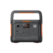
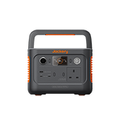
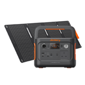
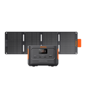
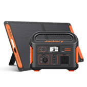
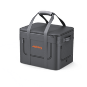
Jackery Explorer 100 Plus
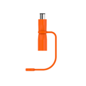
Taking a Jackery Explorer 100 Plus on a hike up Ben Nevis is a strategic decision that prioritises safety and essential power without burdening you with unnecessary weight. While Ben Nevis is a challenging mountain, a power-hungry setup isn't needed for a day hike, making the 100 Plus an ideal companion.

Minimalist Design: The Explorer 100 Plus is an actual minimalist power station. Weighing just 2.13 lbs (965 grams), it's incredibly light and compact for a day hike on Ben Nevis, where every ounce in your backpack matters. This is a huge advantage. It's designed to be a "palm-sized" power source that won't add fatigue or take up valuable space needed for clothing, food, and water.
Aviation Friendly: Its 99Wh capacity complies with airline regulations for carry-on luggage (UN38.3 standard). This means if you're travelling to Scotland from outside the UK, you can easily take the 100 Plus on the plane with you, making it a hassle-free travel companion.
Essential Power Backup: Although its capacity is smaller than that of larger power stations, 99Wh is more than enough for a day hike. It can fully charge a smartphone multiple times, ensuring you have a reliable battery for emergency calls and GPS navigation. Given the unpredictable weather and potential for low visibility on Ben Nevis, a functioning phone is a critical safety tool.
Versatile Charging: The 100 Plus features a variety of ports, including a USB-A port and two powerful 100W USB-C PD ports. This allows you to rapidly charge a modern smartphone, a GPS device, a headlamp, or even a camera battery.
LiFePO4 Battery Technology: The Explorer 100 Plus utilises a LiFePO4 battery, renowned for its exceptional durability and long lifespan. It's rated to retain over 80% capacity after 2,000 charge cycles, providing long-term reliability.
|
Electronics & Devices |
Running Time |
|
Mobile Phone (20W) |
6.2 Charges |
|
Smart Watch (5W) |
15.8H |
|
Flashlight (10W) |
7.9H |
|
GPS Device (20W) |
4H |
|
Radio (20W) |
4H |
(*The running time is provided for reference; the actual working hours are based on usage.)
Campsites Near Ben Nevis
While wild camping is allowed on Ben Nevis, you must adhere to the guidelines. These include travelling in a small group, staying for no more than 2-3 nights, establishing camp away from fields, houses, and highways, and leaving no trace. Below are five campsites near Ben Nevis:
Glen Nevis Caravan and Camping Park
Fort William, Highlands
At the foot of Ben Nevis, there is a family and dog-friendly park with beautiful views, an onsite restaurant/bar and a shop.
Nevis Range Campervan Park
Fort William, Highlands
A family-friendly touring park located near the Nevis Range Gondola offers skiing, snowboarding, biking, and other activities!
Ben Nevis Holiday Park
Fort William, Highlands
Riverside camping and sightseeing with spectacular mountain views. Ten minutes from Fort William and Glen Nevis.
Blackwater Glamping and Campsite
Kinlochleven, Argyll
Located just 15 minutes from Glencoe, these West Highland Way camping and glamping pods are both dog- and family-friendly.
Linnhe Lochside Holidays
Corpach, Fort William, Highlands
In the Highlands, there is a private beach and a tranquil lake where dogs are welcome to camp and travel on the Jacobite railway.
Final Thoughts
Climbing Ben Nevis is a wonderful experience that combines physical challenge with breathtaking natural beauty. Whether you want to finish the Mountain Track or tackle the more tricky Carn Mor Dearg Arête, preparation and respect for the mountain are vital to success. The weather may change quickly, fitness is essential, and suitable equipment is required for safety.
From magnificent summit views to a feeling of accomplishment at the top, Ben Nevis provides an experience unlike any other in the UK. With proper preparation and the correct attitude, your climb will be both unforgettable and immensely fulfilling.