


Hiking with a GPS device alters your trail experience, increasing your confidence and safety in the woods. Whether you're a novice or a seasoned hiker, learning how GPS works, what characteristics to look for, and how to read GPS traces may dramatically improve your hiking experiences.
From smartphones and smartwatches to specialist portable GPS systems, each offers advantages and disadvantages based on your requirements and terrain. This article shows how to choose the appropriate gadget, operate it efficiently, and supplement it with conventional navigation aids such as maps and compasses.
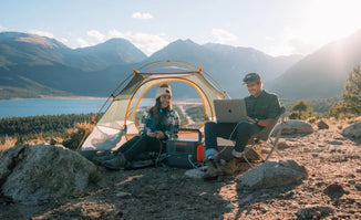
Besides, a Jackery Portable Power Station offers a reliable, high-capacity, and portable power source for hiking, ensuring your critical GPS device and other essentials stay powered throughout your adventure.
|
Key Takeaways: |
|
How Does A GPS Device Work For Hiking?
If you like hiking, you've definitely heard of GPS tracks, also known as GPS routes, GPS trails, etc. GPS traces are significant for hiking because they make it easier to explore paths. A GPS trace includes trail-specific information such as geographical coordinates, altitude, and distance.
You may obtain GPS traces online or generate your own. Most current GPS-enabled devices (smartphones, GPS watches, portable GPS devices, and so on) can display GPS tracks as an overlay (a line) on a map, as shown in the figure to the right.
Working Principles for GPS Devices
Your GPS device works by receiving data from a network of satellites orbiting Earth. GPS devices are handy for walking since they receive position information—latitude, longitude, and altitude —as well as time via the network's continuous radio broadcasts.

Your GPS gadget gathers this essential information by calculating the time it takes for radio signals from at least four satellites to reach the device. This is known as triangulation.
Your GPS gadget will display coordinates and, if your device can show maps, will pinpoint your position on a base or topo map, depending on its capabilities.
If you opt to monitor your walk, your smartphone will leave digital breadcrumbs at regular intervals that you can use later to review the path you walked, including length, distance, and elevation. Similarly, you may opt to use previously plotted waypoints supplied with your GPS device.
However, the system is not without flaws. Gravity may sometimes drag satellites out of orbit, and the Earth's atmosphere can distort radio transmissions.
There are additional factors to consider in the mountains, where topographical features such as cliffs, steep slopes, deep valleys, and forest cover can sometimes lead to erroneous readings. If you're utilising GPS, look for devices that can connect to multiple satellite constellations, as they'll perform better.
How to Use a GPS Device for Hiking?
GPS tracks are files that contain data such as geographical coordinates, altitude, distance, and time in GPX or KML formats, which are XML schemas used by software applications. Does this seem complicated? Let's put it this way: GPS tracks include many locations on the map that create a path (line) to the destination. On your device's display, you can see your current position and heading relative to the walk path (indicated by a line).
Once you have the correct GPS track, you must transmit it to a GPS-enabled device (a smartphone, portable GPS device, or GPS watch). So, how to use a GPS device for hiking?

How to Use a GPS Tracker with a Smartphone?
To utilise GPS tracks on your smartphone, you'll need an app that supports them. I propose using Gaia GPS, which is available on both iOS and Android. Gaia GPS is a simple app that displays the GPS track, your location, and a map on your smartphone's screen.
The program also supports topographic maps (more information here). The main limitation of Gaia GPS is that it requires an internet connection to display the map. This restriction does not apply to the premium edition of the program, which includes offline mapping. Check out the price for the premium version here.
Importing GPS tracks into Gaia GPS is straightforward. Transfer the track in GPX format to your smartphone, then open the file in the Gaia GPS app. Here are more specific instructions for Android and iOS.
Other applications that allow GPS traces include:
Green Tracks (Android Only)
Gaia GPS, AllTrails, Komoot, and A-GPS Tracker are available only for Android devices.
How to Use a GPS Track with a Handheld GPS Device?
Garmin handheld GPS devices also support GPS tracks. Importing GPS tracks to Garmin devices is simple. First, connect your device to your computer with a USB cable. The computer will recognise the device and display a dialogue window.
Select "open folder to view files" and locate the "new files" folder. The folder is occasionally hidden; therefore, activate "show hidden folders" in your file manager. Copy the GPS track (from the internet) to this folder, then choose "Courses" on your GPS device. Find and pick the route that you just imported.
How to Use GPS Track with a GPS Watch?
Many Suunto and Garmin GPS watches feature GPS tracking—for example, Suunto 9, Suunto Ambit, Garmin Fenix, Garmin Forerunner, and so forth. However, most GPS watches do not feature maps. They indicate your position and direction according to the GPS track. This is not an issue if you want to stay on the route, but it gets difficult if you wish to go too far from it. However, the new Garmin Fenix 6X watch can also display maps.
How To Create GPS Tracks?
GPS traces may be created in two ways: with a GPS-enabled device or using software.
Recording GPS Tracks: GPS tracks may be recorded using a smartphone, a portable GPS device, or a GPS watch. We suggest using the Gaia GPS app to capture GPS traces on your smartphone. The program lets you record GPS tracks and export them in GPX format.
If you're using a portable GPS device, you should record your activities and store the track. Then, connect the GPS device to your computer (by USB connection) and copy the file (with the gpx extension) to your hard drive. When you attach the GPS device to your computer, it will appear as an extra disc.
To export a GPS track from a Garmin or Suunto GPS watch, first record your activity and then sync the watch with the Suunto app (Suunto Watches) or Garmin Connect (Garmin watches). Then locate the track in the app and choose "export".
Creating GPS Tracks With Software: The Gaia GPS online app allows you to construct (draw) tracks and routes on a map and then export them in GPX format. The online software includes accurate topographic maps and displays the route's elevation profile. Creating tracks is therefore quite simple.
Types of GPS Devices for Hiking
There are several varieties of GPS devices for hiking, each with unique features and capabilities. GPS devices, for example, may vary in size, battery life, and screen size, and may provide internet connectivity and the ability to import previously recorded GPS trails. We have listed the various types of GPS for hiking below, outlining their benefits and drawbacks so you can choose the device that's ideal for you.

Smartphones App
Smartphones are, without a doubt, the most prevalent devices equipped with GPS, and they can be used as a GPS for hiking with certain apps.
The primary benefit of utilising a smartphone as a GPS is the simplicity of having everything in one device, eliminating the need to purchase additional equipment. However, it should be noted that using a GPS can drain cell phone batteries, potentially leaving them with insufficient power when hiking. Many cellphones struggle to operate at low temperatures and may be damaged by moisture and dust.
For novices, using a smartphone as a GPS is advised; however, it is critical to monitor the device's battery, as this is the only way to notify emergency services in the event of an accident.
Smartwatch/Sportwatch
The vast majority of smartwatches and sportswatches have GPS and may therefore be used as GPS devices for hiking. Smartwatches have grown in popularity over the last several years, evolving to meet consumer demands. There are simpler versions that can perform basic fitness functions, such as recording speed and distance or heart rate, as well as more advanced models that can record altitude, blood pressure, temperature, upload maps and navigate routes.
A smartwatch has many benefits, including its lightweight design, ease of use, and adaptability for everyday use. However, the battery may be insufficient for heavy usage or extended excursions. Furthermore, because these devices have tiny displays, they usually cannot display maps or routes, so a smartphone or a map is required.
Handheld GPS Devices
Handheld GPS devices are among those made exclusively for hiking purposes. These portable gadgets with a map display screen are built to withstand the most extreme conditions.
Handheld GPS systems offer many benefits, including durability in low temperatures and against shocks, a variety of hiking-specific capabilities, and the ability to follow routes directly from the device's screen. The disadvantages include the price, which is, on average, very costly for a product that is gradually being phased out, and the weight, which makes them heavier than other gadgets.
Satellite Messengers
These gadgets are intended to provide enhanced security and to communicate with other devices even when the signal is poor or absent.
Satellite messengers are tiny, stay linked to the satellite network, and may deliver messages and SOS signals as required. You may also link these portable gadgets to your smartphone and navigate using maps. A monthly or yearly subscription is necessary to utilise satellite messengers.
How Do I Choose the Best GPS for Safe Hiking?
When it comes to trekking, particularly in rural or wilderness areas, having a reliable GPS device can make all the difference. It's more than merely knowing your current location. It's about increasing safety, keeping you on target, and providing you with peace of mind. Here's a guide to selecting the best outdoor GPS device for your hiking, along with recommendations for different hiking needs and budgets.
STEP 1: Determine Your Hiking Needs
Choosing the right GPS depends on the type of trekking you do. Here are some such instances to consider:
Casual Day Hikes: If you're hiking established routes with decent cell service, a simple GPS gadget or even a smartphone app should suffice. These tools often include maps and simple tracking.
Backcountry Adventures: For deep-woods or mountain hikes where cell coverage is unpredictable, consider a specialised handheld GPS with topographic charts to help you navigate rugged terrain.
Solo Hiking: If you often go alone or in rural areas, safety is paramount. Choose a GPS with an SOS function or satellite connectivity that can notify rescue agencies in an emergency.
Multi-Day treks: If your treks go more than a day, battery life is critical. Choose a GPS with long-lasting batteries, or even one with solar charging capabilities, to keep you powered for extended excursions.
STEP 2: Tips for Making Decisions Using Hiking Scenarios
There are different hiking scenarios, and other tips accordingly.
Beginner Hikers: A basic GPS device with simple capabilities is excellent for novices who do not need extensive mapping or satellite connection. These types are cost-effective and ideal for shorter, well-marked paths.
Experienced Backpackers: Advanced GPS models with precise topographic maps, waypoint marking, and altitude monitoring are ideal for experienced hikers who travel on unmarked trails and need thorough navigation support.
Hillwalkers and Mountaineers: Look for GPS devices with good weatherproofing, sturdy construction, and barometric altimeters. Some high-end GPS systems provide weather notifications, which are helpful in uncertain alpine climes.
STEP 3: Cost vs. Features: Balancing Budget and Needs
GPS systems vary significantly in price, so consider whether functions are essential for your excursions. Here is a summary of cost factors.
Budget-Friendly Options: Basic GPS devices may start from £46.23 to £138.68. They typically include rudimentary position tracking, waypoints, and simple maps.
Medium-Range Devices: Spending between £184.91 and £323.59 will buy you a GPS device with extra capabilities, such as preloaded topographic maps, altitude tracking, and improved weather resistance.
High-End Devices: High-end GPS systems start at £369.82 and offer sophisticated features such as satellite messaging, SOS functionality, detailed terrain maps, and greater durability.

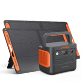
How to Power a Hiking GPS Device with Jackery?
You can choose a Jackery Portable Power Station for hiking because it offers a reliable, high-capacity, and portable source of energy, ensuring your critical GPS device—and other essentials—remain powered throughout your adventure, with the added benefit of solar recharging capability for extended off-grid use.
A GPS device is crucial for navigation and safety on a hike. Jackery units, even smaller models like the Explorer 100 Plus (99.2Wh capacity, ~2.13 lbs) or Explorer 240 v2 (256Wh capacity, ~7.94 lbs), provide significantly more power than standard power banks, ensuring your GPS, smartphone, or satellite communicator stays charged for an extended period.
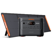
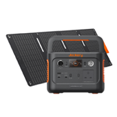
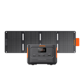
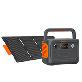
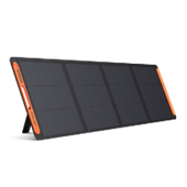
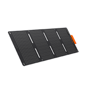
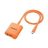
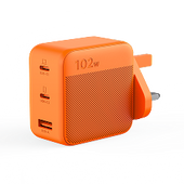
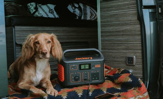
While the GPS is primary, Jackery Portable Power Stations have multiple output ports (USB-A, USB-C, and often an AC outlet) to charge your headlamp, smartphone for communication/backup maps, camera, or drone simultaneously. Here, we recommend the Jackery Explorer 500 v2.
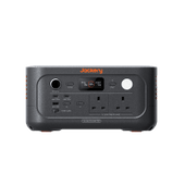
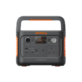
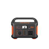
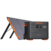
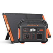
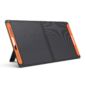
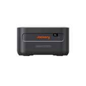
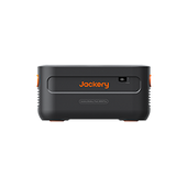
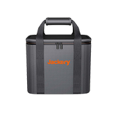
Jackery Explorer 500 v2
The Jackery Explorer 500 v2 is designed explicitly with upgrades that make it a much better fit for outdoor activities like hiking, even though it's still a mid-sized power station. For a hiking GPS device, which typically has a very low power draw (often in the range of 1-5 Watts), the Jackery Explorer 500 v2 provides an enormous reserve of power and efficient charging.

Massive Capacity for Low-Power Devices: With a 512Wh capacity and 500W output, this new Jackery Explorer 500 v2 is just right for weekend hiking or keeping essentials powered during camping. Whether you're charging phones, running lights, or using a small coffee maker, it's got you covered.
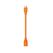
Optimal USB Charging: The unit's USB-A and powerful USB-C ports let you charge your GPS, phone, or satellite messenger directly, without an AC adapter —the most efficient method for small electronics. Using the DC (USB) output maximises the usable energy from the power station.
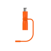
Future-Proof Connectivity: The 100W USB-C PD port is excellent for fast charging modern smartphones, tablets, and even a lightweight laptop, ensuring your communication and mapping backups are always ready alongside your GPS.
Enhanced Safety System: Features a 12-layer BMS (Battery Management System) and advanced safety technology (often referred to as ChargeShield 2.0) to protect against overcharge, over-discharge, over-temperature, and short circuits. The integrated BMS utilises the superior LiFePO4 battery cells and incorporates multiple safety layers. Engineered to support both charging and discharging in a wide operating temperature range: -20°C to 45°C.
Uninterruptible Power Supply (UPS) Function: The Explorer 500 v2 features an actual UPS-like function, providing a seamless power transition. The unit automatically switches to battery power within 10 ms when the main grid power fails.
|
Features of Jackery Explorer 500 v2 |
|
|
Portability |
12.57 lbs and 27% smaller than previous versions. |
|
GPS-Friendly Charging |
USB-C Output (100W Max) and USB-A Output (18W Max). |
|
Battery Life/Chemistry |
512Wh Capacity with LiFePO4 (LFP) Battery (6,000 cycles to 70%+ capacity). |
|
Recharge Speed |
Ultra-Fast AC Recharge: 0-100% in approx. 1 hour. |
|
Durability |
Operates in extreme temperatures -20°C to 45°C. |
|
Running Time |
GPS Device (5W): 38 Hrs Camping Light (5W): 38 Hrs Portable Fridge (60W): 4.5 Hrs Phone (4352 mAh): 17 Times Action Camera (1720 mAh): 64 Times |
Tips for Choosing and Using a GPS Device for Hiking
Investing in a quality GPS device ensures your safety and peace of mind when trekking. Whether you use a specialised portable gadget or depend on your smartphone, the goal is to find a solution that meets your hiking requirements and preferences. Armed with the right GPS technology, you can easily explore the great outdoors and discover new pathways.

When Choosing the Right GPS Unit:
Do you want to utilise a walking, jogging, or cycling GPS gadget to make your outdoor activities simpler, safer, or more enjoyable but aren't sure where to begin? This section discusses several features and functionalities to assist you in selecting the best GPS device for your needs.
Accuracy
The more satellites your gadget can connect to, the better. Outdoor navigation devices are preferable in this regard, however market leaders differ. In general, more cheaper devices link to fewer satellites.
Battery Life
It's pointless to have an accurate equipment for a lengthy adventure if you're also carrying a lot of batteries. You might search for long-lasting field-replaceable battery-powered hiking systems or rechargeable wearable or portable solutions. Some wearables now support solar charging, but it's worth remembering that this won't provide enough power to completely charge your device, so you'll always need to bring a power bank for longer hikes in the hills.
Usability
Most people prefer a bigger screen so that the GPS map can be viewed quickly and easily, and sensitive buttons are particularly useful in the cold. Consider that if your GPS gadget is merely a touchscreen, you will require touchscreen-compatible gloves in the cold. It's also a good idea to test out a few gadgets before making an investment, and select one that fits well in your hand or on your wrist.
Weight
Weight is a significant factor for ultralight enthusiasts and hikers. Balancing this with screen readability, and hence device size, is completely up to you.
Durability
Similarly, a damaged GPS gadget serves no use in the hills. As a result, if you walk all year in the Great British weather, a sturdy and waterproof gadget will probably be preferred to your smartphone for navigation.
For Effective GPS Usage:
Learn The Basics: Before you hit the trail, familiarise yourself with your GPS device's capabilities and settings. For example, with my SPOT gadget, I had to preload my contacts before sending them OK messages. You do not want to be trapped in an emergency circumstance without knowing how to operate your equipment. Also, to make my Suunto watch operate correctly, I upload GPX tracks for simple navigation.
Always Have a Map and Compass With You: While GPS devices are practical tools, it is critical to have conventional navigation tools and experience as a backup.
Update Maps and Software regularly: Keeping your device's software and maps up to date ensures maximum performance and accuracy.
Navigation vs. Communication:
The phrase "GPS device for hiking" is misleading, as hikers use GPS in two different ways. One is navigation, as we've discussed: maintain the dot (your position) on the line (the trail) or use a topographic map to plot your course over the area.
Another significant application of GPS when trekking is to communicate your whereabouts. Even in the absence of cell coverage, a satellite communication device or GPS tracker may communicate your GPS position and other information, including a bespoke message. The two most popular gadgets in this category are the SPOT and the Garmin InReach (I prefer the InReach Mini).
Both kinds of GPS devices are aware of your location, but one is designed to assist you in navigating a path or map, and the other is designed to communicate your position.
FAQs
The following are the frequently asked questions about the GPS device for hiking:
1. Can I use my phone as a GPS while hiking?
The good news is that GPS does not require cellular coverage or Wi-Fi to function. Furthermore, the latest smartphones are equipped with GPS chips, making them equally useful for walking, jogging, and hiking.
2. Are hiking GPS worth it?
GPSs are helpful when you are going off route, climbing in alpine environments, travelling in areas where the path is covered (for example, snow), or when you need navigation in really cold or rainy conditions, when your phone may not work well.
3. How to use GPS without internet?
A prevalent misperception regarding GPS is that it requires a data connection to operate. Not so! The GPS on your phone operates entirely independently of data and receives signals from satellites. Another popular misconception connected to the first is that you must pay for additional data to utilise GPS on your phone.
4. How does GPS work for dummies?
A receiver, such as one found in your phone or your parents' vehicle, is continually listening for a signal from these satellites. The receiver determines how far apart they are from certain of them. When the receiver calculates its distance from four or more satellites, it knows precisely where you are. Presto!
5. What should you do when using a GPS device?
Limit your interaction with GPS while driving. Make modifications before you begin and prevent distractions. Change settings before the journey - If you need to avoid tolls or certain roads, or set other preferences, do it before you go. Do not type or text. Never input an address or search for locations while driving.
Final Thoughts
Using a GPS device for hiking is more than just technology; it's also about planning, safety, and confidence. While smartphones are convenient, portable GPS systems and smartwatches provide durable, purpose-built functionality for harsh outdoor settings. No matter your level of skill, understanding how to utilise GPS tracks, keep devices charged, and complement with conventional tools like a map and compass is critical.
Choose a gadget that meets your requirements, completely understand its functionality, and always keep a backup. We highly recommend the Jackery Portable Power Station for powering the GPS device or other electronics while hiking.