


As the UK gets ready for an active weather season in 2026, a lot of people are questioning when the next storm will hit the country to secure their houses. Storm Ingrid and other recent events have shown how rapidly things can change, going from torrential rain to freezing blizzards.
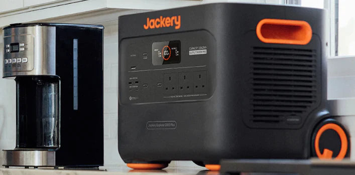
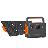
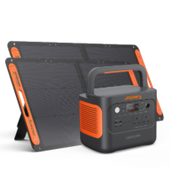
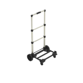
It's a good idea to have a backup plan in case of power interruptions so you can stay calm. The Jackery Explorer 3000 v2 and the Jackery Explorer 2000 v2 both have a lot of portable power that can keep your important appliances and communication cables operating.
This tutorial looks into the most recent weather patterns to help you keep one step ahead of the next storm in the UK.
|
Key Takeaways: |
|
l By the end of January and the beginning of February, winter is expected to bring back colder weather. This week, cold air from the east will clash with milder air from the west. Cold air will probably win and stay cold until next week. l The jet stream acts as a high-altitude conveyor belt that directs powerful low-pressure systems across the Atlantic directly toward the United Kingdom. l While climate change may result in fewer storms overall, a warming atmosphere causes more severe storms with increased moisture and devastating surface winds. l Maintaining a reliable backup with the Jackery Portable Power Station provides essential power for communication devices and medical equipment during a blackout. |
When Is the Next Storm Coming to the UK?
By the end of January and the beginning of February, winter is expected to bring back colder weather. This week, cold air from the east will clash with milder air from the west. Cold air will probably win and stay cold until next week. People may be wondering when the next storm will hit the UK, and certain places may have a higher chance of sleet and snow. However, it is not yet clear which areas are most likely to be impacted.
But before the weather becomes colder, we may expect another round of rain and wind during the next several days. Low pressure in the southwest will keep pushing rain and strong winds northeast throughout the UK for the next several days. This will keep the weather mild and uncertain until the middle of the week.
There is a yellow weather warning from the Met Office for heavy rain in northeast Scotland from Wednesday to Friday. The ground is already damp from the rain and melting snow that fell recently. If it rains 80 to 120mm in a few days, it might trigger isolated flooding, which would make a lot of people wonder when the next storm would hit the UK today.
When Will The Air Get Colder?
On Thursday and Friday, the weather in the north is expected to be a little colder. In Scotland, especially in the Grampians and Highlands, there may be snow over high hills. This week, temperatures in most places should be close to the average for January.
However, they should drop below that level during the weekend and during the last week of January. If you're wondering when the next storm will hit the UK tomorrow, it's worth noting that long-range weather models largely agree that temperatures will drop more widely during the following week, but the change won't be clear-cut.
The UK will be on the edge of cold and warm weather because there will be high pressure to the east and low pressure to the west. Because the UK is an island nation on the edge of a huge continent, it's hard to predict snow there. The weather in Britain generally comes from the west, moving in from a calm Atlantic.
But in the winter, when winds come from the Arctic or Siberia, it may get chilly and snowy. A difference of only one or two degrees may make the difference between rain, sleet, or snow, thus forecasters often don't get too specific about snow specifics until a few days before. No matter how accurate it is, the issue of when the next storm will hit the UK is still important for planning for the season.

Storm Tracking and Weather Warnings
The best approach to get ready for changing situations is to stay up to date. The official UK Storm Centre is the best place to find out when the next storm may hit the UK. It gives real-time information on named systems and their expected routes across the Atlantic.
The National Severe Weather Warning Service sends out colour-coded alerts—yellow, amber, and red—that explain what rain, wind, and snow might do to your area right away. People in the UK can get prior warning of "explosively deepening cyclones" or unexpected changes in the jet stream by monitoring these tools for information on when the next storm is approaching.
Also, the interactive rainfall radar map lets you keep track of precipitation quite accurately. This helps those who are worried about when the next storm will hit the UK tomorrow organise their travel and outdoor activities more accurately.
Storm Tracking: https://weather.metoffice.gov.uk/maps-and-charts/uk-weather-map
Weather Warnings: https://weather.metoffice.gov.uk/warnings-and-advice/uk-warnings
What Causes the Storms in the UK?
The jet stream is mostly to blame for the UK's bad weather reputation. The jet stream is a core of powerful winds that moves far up in the sky, around 5 to 7 miles (8 to 11 km) above the Earth's surface. These winds travel from the west to the east, pushing strong low-pressure systems across the Atlantic straight to the UK. The Met Office says that the jet stream is driven by the difference in temperature between the frigid polar air in the north and the warm tropical air in the south.
Changes in atmospheric pressure cause air to move, which starts storms. The Coriolis effect makes this wind whirl around places of lower pressure when the Earth turns. This creates a cyclone or storm.
When there is a bigger difference in pressure, the gradient gets steeper, which is what causes the strong winds that are common in named storms. Also, the jet stream may operate like a hoover, "sucking" air out of the top of a low-pressure system. This makes the pressure drop and the storm get stronger.
These systems move a lot of moisture through the air. When warm, wet air is pushed up, it cools and condenses into clouds. This releases latent heat energy, which can make the storm more stronger. The jet stream pushes these systems across the huge Atlantic Ocean, where they pick up a lot of moisture. This is why they often bring heavy rain and floods to the UK.

Recent Storm Activity and Forecast
Storm Ingrid recently hit the UK, bringing heavy rain and strong waves to the southwest. It caused damage to the structure of Teignmouth Pier, among other things. Right now, several areas are seeing a combination of rain and snow, and there is a yellow weather warning for heavy rain in certain parts of Scotland. If you're wondering when the next storm will hit the UK today, the latest forecasts say that it will keep raining and be chilly.
A big snowstorm is on Tuesday, January 27, 2026. It is likely to produce a lot of snow (70%) and a lot of precipitation. This new method is a vital point for anyone who wants to know when the next storm will hit the UK tomorrow and in the days after that. As these technologies improve, officials recommend keeping up with the latest Met Office advisories.
What Can We Expect for the 2025-26 Storm Season?
Storminess in the British Isles fluctuates greatly from year to year, making accurate long-term forecasting difficult. For comparison, the 2022/23 season saw just two named storms, but the following year saw twelve.
While the number of named systems is not an exact measure of overall weather intensity, it does emphasise the underlying diversity of the UK climate. Storms are called by the Met Office when they have the potential to have medium or high effects, which usually result in amber or red weather warnings.
Key Drivers: La Niña and the North Atlantic Oscillation
The El Niño Southern Oscillation (ENSO) is a major cause of seasonal fluctuations, according to experts. Seasonal models indicate a modest La Niña in 2025-26, with cooler-than-average temperatures in the tropical Pacific. According to Dr. Matt Patterson, a research fellow at the National Centre for Atmospheric Science and the University of St Andrews, La Niña is often associated with a positive North Atlantic Oscillation (NAO), which leads to more severe weather in the UK.
However, other atmospheric elements might work against this tendency. Recent sub-seasonal forecasts from the European Centre for Medium-Range Weather Forecasts (ECMWF) suggest the likelihood of a weak polar vortex. This might trigger a Sudden Stratospheric Warming (SSW) event, which usually leads in a shift towards cooler, more stable weather and a decrease in storm track activity.
Comprehending Model Uncertainty
It is very hard to predict the details of a winter season since the exact "hit point" of Atlantic depressions, whether they hit Scotland or travel south towards France, changes the local influence completely. Dr. Antje Weisheimer, a researcher at the University of Oxford, says that different international models typically give different predictions.
Some forecasts, like the Australian and French ones, say that this winter will be quite windy. Other models, like the Japanese and ECMWF ones, say that this winter will be calm.
|
Driver |
Potential Impact on UK Storms |
|
Weak La Niña |
Often increases the frequency of Atlantic storms and wet weather. |
|
Polar Vortex Collapse |
Can lead to colder, drier, and less windy conditions (SSW). |
|
Jet Stream Position |
Determines if the core of the storm hits the UK or Southern Europe. |
The UK Met Office's long-range ensembles don't always show a clear trend, so it's important to keep up with short-term forecasts. If you're wondering when the next storm may hit the UK today or tomorrow, it's important to keep an eye on the latest warnings. The storm list for 2025-26, which includes names like Amy, Bram, and Chandra, is ready to go as the season moves through its busiest months.
Will Climate Change Increase the Frequency and Severity of Storms?
It's hard to find long-term patterns in storminess since the frequency and strength of storms varies a lot from year to year. But scientists are becoming more and more sure that storms will get worse as the atmosphere warms.
Dr. Ben Harvey, a research scientist at the National Centre for Atmospheric Science and the University of Reading, says that climate change caused by humans makes the atmosphere warmer and more humid. This makes clouds condense more, which gives off energy and makes storms stronger.
Because of this, it is expected that heavy rainstorms will happen more often and storms with strong surface winds would be more damaging. The most dangerous storms in the UK are explosively deepening cyclones, which get stronger very quickly. They are especially likely to build when there is a lot of moisture around.
Preparing for the Upcoming Storms in the UK
To be ready for bad weather, you need to do things before, during, and after the event to keep yourself and your property safe. Getting ready starts with making sure the house is safe. People should look for loose roof tiles, sweep moss and leaves from the gutters, and make sure that the fences and gates are in excellent shape.
When it's windy, things like trampolines and garden equipment that are outside should be secured or brought inside since they might become hazardous missiles. The ideal place to park a car is in a garage or away from buildings and trees so that it doesn't get damaged by falling debris.

Safety During The Storm
The main priority after the storm starts is to stay inside. If a window breaks, safety rules say to remain away from windows and keep inside doors locked to avoid damage to the building. Drivers should stay on main highways and be especially careful in open regions if they really have to travel. They should also retain a tight hold on the steering wheel.
When the power goes out, it's better to use battery-powered flashlights instead of candles since they don't start fires. If you want to be sure you have a solid backup, a high-capacity unit like the Jackery Explorer 3000 v2 or the Jackery Explorer 2000 v2 can provide you the power you need to keep your communication and medical devices running during a blackout.
Recovery After The Storm
Even once the weather has calmed down, you still need to be careful. Never touch electrical or phone lines that have been blown down. Also, it's best to stay away from walls or structures that may have been undermined.
Homeowners should call their insurance company as quickly as possible if there is damage, but they should only try to fix it when it is safe to do so. If you want to know when the next storm is coming to the UK, the best approach to be prepared for any future weather fronts is to keep an eye on official weather warnings and local news.
Essential Storm Emergency Kit Checklist
Every home should have an emergency kit that includes:
A list of emergency phone numbers (on paper).
A torch and radio that run on batteries, along with extra batteries.
A first aid kit and any medicine you need.
Three days' worth of bottled water and food that is ready to consume.
Extra keys for the house and car.
Clothes that keep you warm, blankets, and strong shoes.
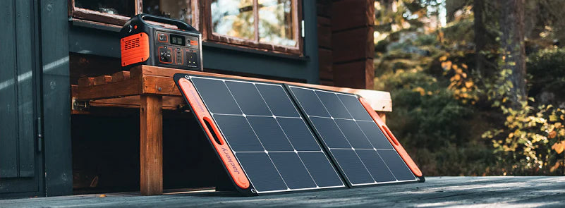
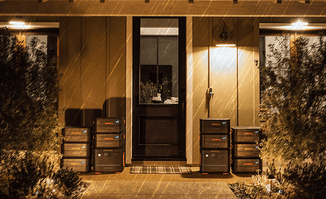
Reliable Home Backup: Jackery Portable Power Stations
When preparing for severe weather, ensuring a consistent power supply is a top priority. Whether one is wondering when is the next storm coming to the UK to protect electronics or to keep essential appliances running, having a dedicated portable power station can make a significant difference during a blackout. Choosing a Jackery Portable Power Station in these specific moments offers several strategic advantages over other backup methods.
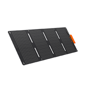
Several Jackery models (like the Explorer 2000 v2) feature an Emergency Super Charge mode. You can recharge the unit from 0% to 100% in as little as 1 hour via a standard UK wall outlet. Even if you receive a last-minute Amber warning, you have enough time to fully prime your backup battery before the grid potentially fails.
With a UPS (Uninterruptible Power Supply) rating of <20ms, you can plug your router or PC into the Jackery now. If the power blinks or cuts entirely, your internet stays alive, and your work isn't lost. This is vital for those working from home during severe weather.
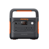
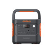
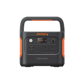
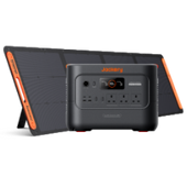
Jackery Explorer 2000 v2
The Jackery Explorer 2000 v2 is a powerhouse specifically designed for high-capacity home backup while being significantly more compact than its predecessors. Released as a refined version of their flagship line, it balances high wattage with a much more manageable size for the average UK home.

High Output for "Heavy" UK Appliances
British households often rely on high-wattage appliances like kettles and microwaves which can trip smaller power stations. 2200W continuous and 4400W surge: This is high enough to power a standard kettle, toaster, microwave, or even a hair dryer—items that most portable batteries simply cannot handle. 2042Wh capacity: This large battery reservoir can keep a high-efficiency UK fridge-freezer running for up to 15-20 hours, ensuring your food doesn't spoil during an overnight blackout.
Industry-Leading Compactness
Space is often at a premium in UK homes compared to the US. The "v2" is a major upgrade in design. 40% Smaller & lighter: Despite having the same capacity as older 2kWh models, the v2 is roughly 41% smaller and weighs only 38.6 lbs. Stow-away handle: Its foldable, flat-top design means you can easily store it on a shelf in a utility room or under a kitchen bench without it becoming a bulky obstacle.
"Emergency Super Charge" Mode
One of the most critical features for emergencies is how fast you can "top up" when an emergency warning is issued. Using the Jackery app, you can activate the Emergency Super Charge mode, which pulls maximum power from your wall socket to go from 0% to 100% in just over an hour.
You can leave it plugged into your router or PC. If the grid fails, it switches to battery power in less than 20 milliseconds, preventing your internet or work from dropping.
Advanced LiFePO4 Safety & Longevity
Unlike older lithium-ion batteries that might degrade after 500 charges, the Explorer 2000 v2 uses LiFePO4 (Lithium Iron Phosphate) chemistry. It is rated for 4,000+ charge cycles, meaning if you used it every single day, it would still have 70% of its capacity after a decade. It produces no fumes, no carbon monoxide, and operates at a silent 30dB in quiet mode—essential for use in bedrooms or small flats during the night.
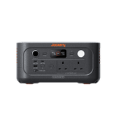
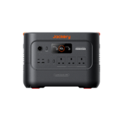
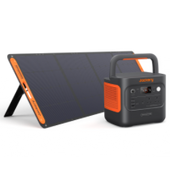
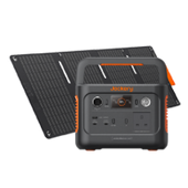
Jackery Explorer 3000 v2
Choosing the Jackery Explorer 3000 v2 for emergency preparedness in the UK is a strategic move, especially considering the country's recent focus on grid resilience. This model represents a significant generational leap over the older "Pro" series, specifically addressing the needs of home backup.

Massive Output for British Appliances
The Explorer 3000 v2 offers a 3,600W continuous AC output (with a 7,200W surge). In a UK context, this is a "magic number" because it can comfortably handle high-wattage appliances that smaller units struggle with. Unlike smaller power stations, it can run a standard 3kW UK kettle. It can power space heaters or portable induction hobs during winter power cuts.
"ZeroDrain" Technology for Long-Term Storage
The biggest risk with emergency gear is finding it dead when you actually need it. The 3000 v2 features ZeroDrain technology, which allows it to retain up to 95% of its charge even after sitting in a cupboard for a full year. This "set it and forget it" reliability is critical for an emergency kit.
Rapid UPS (Uninterruptible Power Supply)
During a "brownout" or sudden power cut, the unit features a sub-20ms UPS switchover. If you have your essentials (like a desktop PC, medical equipment like a CPAP, or your Wi-Fi router) plugged into it, they won't even flicker or reboot when the grid fails.
LiFePO4 Chemistry & 10-Year Lifespan
While older Jackery models used Lithium-ion, the v2 uses LiFePO4 (Lithium Iron Phosphate). This chemistry is significantly more stable and less prone to overheating, making it safer to keep inside a UK home. It is rated for 4,000+ charge cycles to 70% capacity. Even if used frequently, the battery is designed to last over a decade.
Compact "Cell-to-Body" (CTB) Design
UK homes are often tighter on space than US homes. The v2 is 47% smaller and 43% lighter (weighing about 59.5 lbs) than typical 3kWh competitors. It doesn't require a trolley or wheels to move between rooms, making it much easier to store in a utility cupboard or under a stairs.
FAQs
The following are frequently asked questions about the next storm in the UK.
1. Will there be more storms in the UK?
Yes, there will be more storms as the 2025-26 season goes on through the end of winter and the beginning of spring. There has been a combination of steady cold and active weather in January 2026. However, projections for February and March show that winds from the Atlantic are more likely to come.
This trend usually delivers warmer but considerably wetter and windier weather. This means that additional named storms are likely to happen before the season ends in August. If you're keeping an eye on when the next storm may hit the UK, it's important to be awake throughout these months of change.
2. Where is storm Goretti going to hit?
Storm Goretti, which is also known as Garetti, hit the UK on January 8 and 9, 2026. Météo France dubbed this multi-hazard storm, which mostly affected the far southwest of England. The Isles of Scilly and Cornwall were impacted the worst.
St. Mary's Airport recorded gusts of wind that broke records at 99 mph. Goretti also delivered a lot of snow to a large area of Wales, the West Midlands, and the South Pennines on its northern side. This caused a lot of transport problems and power disruptions.
3. Where is storm Claudia going to hit in the UK?
In the middle of November 2025, Storm Claudia hit the UK. Claudia stayed in the southwest, unlike systems that go straight over the UK. However, her related weather fronts produced very heavy rain to South Wales and central England.
The River Monnow caused a lot of flooding in Monmouth, hence a major incident was proclaimed. Somerset and the Midlands also got yellow and amber warnings because the storm brought over a month's worth of rain in only a few days.
4. Where is Storm Bert going to hit in the UK?
Storm Bert was a big deal in the 2024-25 season. It reached the UK in late November 2024. It delivered a mix of heavy snow and ice to Scotland and Northern England. In the south and west, especially in Devon and South Wales, there were heavy rain and strong winds along the coast. The Scottish Highlands saw the greatest winds during Storm Bert, with gusts of up to 113 mph near Cairn Gorm.
5. What is the bad storm in the UK 2025?
Storm Éowyn, which hit on January 24, 2025, was the worst storm of the year. Meteorologists said it was the strongest windstorm to hit the UK in more than ten years. The storm went through "explosive cyclogenesis," which means that the pressure dropped by 50hPa in under 24 hours. It sent a red "danger to life" warning to Northern Ireland and Scotland's Central Belt, where winds hit 100 mph.
This one incident knocked off electricity to almost a million homes and caused a lot of damage to buildings in the northern region of the UK. For anyone who want to know when the next storm will hit the UK today, Éowyn is a reminder of how rapidly these systems may get stronger.
Final Thoughts
Understanding when is the next storm coming to the UK is the first step toward seasonal resilience. As the weather changes and storms get stronger, it's more vital than ever to be ready ahead of time by doing things like making sure your property is safe and checking local flood alerts.
Getting a strong solution like the Jackery Portable Power Station will keep your home running, whether you need to power medical equipment or just keep the lights on when the grid goes down. For the safest winter season possible, be alert, keep your emergency kit supplied and constantly check the latest advice from the Met Office.